Thursday, October 22, 2015

Post 3: Data Gathering

Introduction:

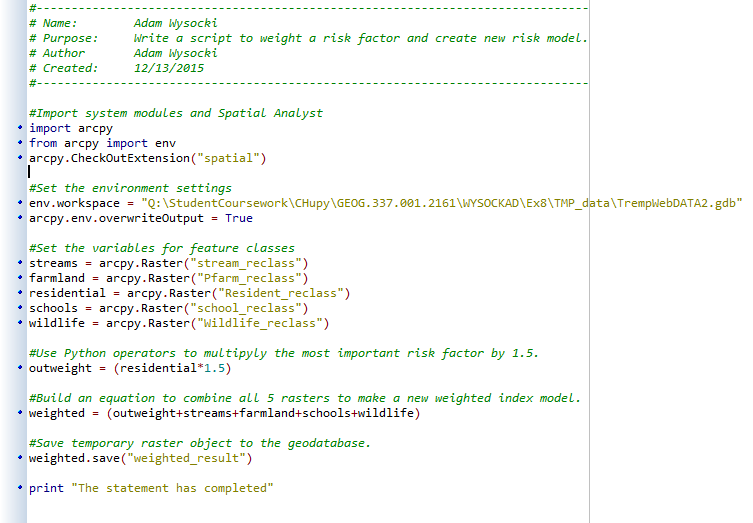
The goal of this exercise was to gain familiarity downloading data from different sources. Initial data for the suitability and risk model for sand mining in Western Wisconsin was collected from a variety of federal government agencies and Trempealeau County. The data was imported into a working folder and then moved to a geodatabase. Understanding how to collect data from different sources is important to future success in the geospatial world.

Methods:

To create a frac sand minnig suitability and risk model, specific data was collected to map in ArcMap. The following lists what sources were used for the model, what data was collected, and how the data was obtained:

U.S. Department of Transportation

Railroad data for the United States was collected from the USDOT website. Information about railroads is useful  because frac sand mines need to be close to railroads in order to ship their sand to consumers.

Accessing railroad data:
Once you have downloaded the Trempealeau County geodatabase (later in the lab), come back to these steps:
  • Add the NTAD rail_lines shapefile from the USDOT data to ArcMap
  • Add the railroads feature class from the Trempealeau County geodatabase
  • Clip the NTAD rail_lines shapefile to the Trempealeau County boundary 
    • Import into the Trempealeau County Transportation feature dataset

See Figure 1 for a summary of the data.


USGS National Map: Landcover

Data for landcover of the United States was collected from the United States Geological Survey's National Map, which is a data resource that has data on elevation, landcover/landuse, hydrography, and more.

To access data on landcover:
  • Go to the National Map website: http://nationalmap.gov/about.html
  • Clici on "National Map Viewer and Download Platform"
  • Click on "TNM Download Client" 
  • Select Trempealeau County as your area of interest using the Box/Point Polygon Tool
  • Select "National Land Cover Database 2011" as your desired dataset. 
  • Download the zip to your temporary folder
  • Unzip data to working folder

See Figure 1 for a summary of the data.


USGS National Map: Digital Elevation Model

The National Elevation Dataset (1/3 arc second) for Trempealeau County was downloaded from the USGS National Map using the same procedure for downloading landcover data, with a few extra steps:
  • Select Trempealeau County as your area of interest again
  • View products for Trempealeau County
  • Select "National Elevation Dataset (1/3 arc second)"
    • use the ArcGrid format
  • Download data for both n44w092_13 and n45w092_13. 
  • Download zip folders to your temporary folder
  • Unzip data to working folder
See Figure 1 for a summary of the data.


U.S. Department of Agriculture: Cropland

Information about cropland in Trempealeau County was downloaded because it is important to know if agriculture already exists in areas you plan to open a frac sand mine.

Accessing cropland data:
  • Go to the USDA Geospatial Data Gateway: https://gdg.sc.egov.usda.gov/
  • Click on the "Get Data" button
  • Select "Wisconsin" and "Trempealeau County"
  • Check "Cropland Data Layer by State" under "Land Cover"
  • Send request for data
  • Receive an email and download the data from the link
  • Download zip folders to your temporary folder
  • Unzip data to working folder
See Figure 1 for a summary of the data.


Trempealeau County Land Records: 

The entire geodatabase for Trempealeau County was downloaded from the county's website: http://www.tremplocounty.com/landrecords/.


USDA NRCS Web Soil Survey:

Information about soil was collected because it can tell us important soil information, including soil type and drainage.

To access soil data:
  • Go to http://websoilsurvey.sc.egov.usda.gov/App/HomePage.htm
  • Set Trempealeau County as your AOI
  • Go to the "Download Soils Data" tab and find Trempealeau County
  • Download the zip file and unzip the file in Windows Explorer
  • Use Microsoft Access to import the txt files your geodatabase 
  • Go to ArcCatalog and find the soildb_WI_2003.mdb
  • Import the soilmu_a_wi121.shp into the Trempealeau County geodatabase you downloaded earlier
    • name it soilmu_a_wi121_2
  • Import the "component table" to the Trempealeau County geodatabase from the soildb_wi2003 geodatabase
  • Create a relationship class between the "component table" and the soilsmu_a_wi121 feature class
  • Add the soilsmu_a_wi121 feature class and "component" geodatabase to ArcMap
  • Join the "component" table to the soilmu_a_wi121 feature class 

See Figure 1 for a summary of the data.


Last Step for downloading the data:
  • Combine the two DEM's for n44w092_13 and n45w092_13 using the "Mosaic to New Raster" tool in ArcMap. 
    • Save the output properly to avoid truncating the values

Figure 1: Data was gathered from the above resources. See above instructions for specifics on downloading the data.


Results:

Metadata:

Metadata is important because it can tell you how suitable data is for your project. Useful information included in metadata includes how the data was created, who created it, what is has been used for, how accurate it is, and more. The table below shows the metadata for all the data sources in this exercise (Figure 2). Metadata was compiled from metadata files/links for each separate piece of data.

I would say the metadata was well suited for the purposes of our studies. The data is mostly current, and is accurate at the county-level scale. Although the metadata was sometimes hard to locate, I was able to find most of the metadata. The only part of the metadata that was hard to locate was the attribute accuracy and minimum mapping unit.

Figure 2: Metadata for the collected data.

Reference List: 

Trempealeau County. (2015). Trempealeau County Land Records [geodatabase]. Retrieved from: http://www.tremplocounty.com/landrecords/

United States Department of Agriculture. (2015). NRCS Web Soil Survey [soil data set]. Retrieved from: http://websoilsurvey.sc.egov.usda.gov/App/HomePage.htm

United States Department of Agriculture. (2015). USDA Geospatial Data Gateway [cropland data set]. Retrieved from: https://gdg.sc.egov.usda.gov/

United States Department of Transportation. (2015). National Transportation Atlas Database [rail network data set]. Retrieved from: http://www.rita.dot.gov/bts/sites/rita.dot.gov.bts/files/publications/national_transportation_atlas_database/index.html

United States Geological Survey. (2015). The National Map [landcover and digital elevation model data sets]. Retrieved from: http://nationalmap.gov/about.html


Post 2: Python Scripting

Python Scripting:

Goal: 

The goal of these exercises is to practice creating python script for use in the suitability and risk model for sand mining in Western Wisconsin. By using Python, we will efficiently manage and analyze collected data.

Background:

Python is a basic scripting language that is used to automate computing tasks. Automation makes work faster, easier, and more efficient. Other advantages of Python are that it is easy for beginners to understand, requires little overhead, and is free to use. Although Python is well suited for GIS work, it is useful in many other computer science areas (John A. Dutton E-Education Institute, 2014).

Python Scripts:

Python Scrip 1: 

Figure 1 shows Python script used in the first and third exercises. The script was used to project different data sources into one coordinate system, clip the feature class to the county boundary of Trempealeau County, and load the projected and clipped feature classes into a geodatabase.


Figure 1: A screenshot of the Python script in Pyscriptor.

Python Script 2:

Goal:

The goal for this script was to select frac sand mines suitable for network analysis in our class project, which is focused on creating a suitability model for frac sand mining in Wisconsin. These mines had to fit the following criteria:
  • Must be active 
  • Mine must not have a rail loading station. Mines with a rail loading station will use the rails to transport their sand, not the local roads. We are focused on mining's impact on local roads. 
  • Must be 1.5 km away from any rail roads. Rail road data is not totally up to date, and mines closer than 1.5 km may have had a rail spur built to them within the past few years.
Background: 

In order to use frac sand in hydraulic fracking, the sand has to be transported from the mining site to the user. It it quite typical for mines to use rail roads to transport sand to the user. The only problem is that sand mines are usually in rural locations, and are often not near rail roads. In order to get their sand to the rail roads, mine operators will use trucks. The roads that mines are located on are usually local roads that are not built to withstand heavy loads with heavy traffic.

The suitability model we create will determine the cost of transporting sand on Wisconsin roads. This will enable land planners to make better-informed decisions on where to allow frac sand mines.

Python Script: 

Figure 2: The python script for this exercise used SQL statements to select frac sand mines suitable for network analysis. The SQL statement was based off criteria listed in the Goal section.  

Python Script 3: 

The objective of this script was to multiply a factor in the frac sand mining risk model, built in Exercise 8 (see post 6), by a weight of 1.5. This would weight the most important risk factor, which would influence the overall results of the mining suitability model accordingly.

A short python script was created in order to weight the most important risk factor. All risk factors were set up as variables in the script, the most important factor was multiplied by 1.5, and the result was added with the other risk factor rasters to create a newly weighted risk model. The python script is seen below (Figure 3). 

Figure 3: The python script used raster calculator to multiply the most important mining risk factor by a weight of 1.5. The result was added to the other risk factors to create a newly weighted risk model for frac sand mining in Trempealeau County.

Reference List:

John A. Dutton E-Education Institute. (2014). " What is Python". In "Lesson 1: Introduction to GIS modeling and Python" (Section 1.4.2). Retrieved from: https://www.e-education.psu.edu/geog485/node/104

Wednesday, October 21, 2015

Post 1: Sand Mining in Wisconsin

Introduction:

The purpose of this exercise was to enhance my skills at downloading data from different internet sources, importing data into ArcGIS, joining data, projecting data from multiple data sources into one coordinate system, and designing a geodatabase to store the data.

This exercise will provide an overview of sand mining in Wisconsin and give background into a multiple-step project for which the class will build a suitability and risk model for sand mining in Western Wisconsin.

Background:

What is frac sand mining, and where is it in Wisconsin?

Frac sand mining is the mining of quartz sand of specific size and shape to be used in "hydrofracking". Hydrofracking is a process used to extract oil underground in which frac sand is suspended in fluid and pumped down at high pressure into a formation containing oil. Fracking fluid pumped at high pressures creates fractures in the rock formations and the sand holds open the fractures. This allows oil to escape from the fracture and be pumped back to the surface (Figure 1). Frac sand mining has been used by the United States' oil and gas industry for 75 years. Recent developments in fracking include the use of horizontal drilling, which allows drillers to access natural gas resources that were previously unreachable. (Wisconsin Geological and Natural History Survey, 2012).

Frac sand is mostly found in Western and Central Wisconsin. This is because these areas contain easily accessible deposits of high quality frac sand. The largest number frac sand mines per county occur in Trempealeau and Chippewa Counties (Wisconsin Geological and Natural History Survey, 2012; Figure 2)

Figure 1: The figure shows the process of hydrofracking (bottom left), a frac sand mining site (upper right), and frac sand under a microscope (bottom right).


Figure 2: The map show the locations of frac snad mines and pocessing plants active or in development in Wisconsin in 2011. Most frac sand mines are on the western side of the state. Note that there is a strong concentration of  frac sand mines in Trempealeau County.

Environmental concerns about frac sand mining:

One environmental concern associated with frac sand mining in Western Wisconsin is its impact on air quality. Air quality concerns include increased particulate levels in areas near frac sand mines and air pollution emitted from machinery used at frac sand mines (Wisconsin Department of Natural Resources, 2012).

Another issue with frac sand mining involves protection of water. Some people are concerned about the amount of groundwater frac sand mines use to clean their sand with. Additionally, heavy rain can lead to sediment spills at frac sand mining sites. For example, a holding pond was breached at a frac sand mine in Barron County, WI, due to heavy rains. Spills can pollute nearby areas, but the Wisconsin Department of Natural Resources has stated that frac sand mines have developed and implemented better technology that has cut down on the number of spills (Wisconsin Public Radio, 2015).

A common concern about frac sand mining is that increased semi truck traffic on roads near frac sand mines could deteriorate the roads. Studies conducted by the Minnesota Department of Transportation and Wisconsin Department of Transportation have concluded the additional stress due to semi truck traffic on roads near frac sand mines is minimal. This is because local governments usually work with sand companies to make sure sand companies pay for any damages to roads on sand hauling routes. Additionally, the frac sand industry is moving away from transporting sand by truck and using railroad more because it is much cheaper. This further reduces the sand industry's impact on local roads (Burnett, 2015).

Other concerns about frac sand mining include damage to fisheries, dust inhalation by workers and people nearby, and noise pollution (Wisconsin Department of Natural Resources, 2012).

GIS and frac sand mining

Geographic Information Systems (GIS) is a tool used for storing, analyzing, and mapping geographic data. Geographic data is used in all kinds of workplaces, including environmental consulting, healthcare consulting, business planning, and more.

GIS will be used in this exercise as the first part of a multiple-step project for which the class will build a suitability and risk model for sand mining in Western Wisconsin. Using geographic models will help make better informed decisions on where to establish, or prevent the establishment, of new frac sand mines in Western Wisconsin.

Methods:

Data was collected from a variety of federal government agencies and the Trempealeau County data website. Collected data was imported into a geodatabase in ArcCatalog, and the data was then used in ArcMap 10.3.1 to create maps of relevant data. See "Post 3: Data Gathering", for a more detailed explanation of the methods for this exercise.

Results:

Data for Trempealeau County (Figure 3) was collected from multiple sources (see blog 3), and included the following information: landcover (Figure 4), elevation (Figure 5), and cropland type (Figure 6). The maps all included railroad locations because railroads are important to have near frac sand mines for transporting sand to consumers. The datasets will be used in the on-going class project in which our class will build a suitability and risk model for sand mining in Western Wisconsin.

Figure 3: The locator map shows Trempealeau County is located on the western side of Wisconsin.

Figure 4: Landcover for Trempealeau County in 2011.

Figure 5: Elevation values for Trempealeau County.

Figure 6: Cropland in Trempealeau County.


Reference List:

Burnett, H. S. (2015, October, 9). "States, Localities Handling Road Issues Related to Frac Sand Mining". Heartland. Retrieved from: http://news.heartland.org/newspaper-article/2015/10/09/states-localities-handling-road-issues-related-frac-sand-mining

Kremer, R. (2015, September, 23). "DNR Investigatin Frac Sand Spill In Barron County". Wisconsin Public Radio. Retrieved from: http://www.wpr.org/dnr-investigating-frac-sand-spill-barron-county

Wisconsin Department of Natural Resources. (2012, January). "Silica Sand Mining in Wisconsin". Retrieved from: http://dnr.wi.gov/topic/Mines/documents/SilicaSandMiningFinal.pdf

Wisconsin Geological and Natural History Survey. (2012). "Frac Sand in Wisconsin". Retrieved from: http://wcwrpc.org/frac-sand-factsheet.pdf